Mesoscale Discussion
Valid: Sat 24 May 2025 13:00 to Sat 24 May 2025 16:00 UTC
Issued: Sat 24 May 2025 12:23
Forecaster: TUSCHY
This Mesoscale Discussion was issued to highlight an imminent severe risk with a few extreme events not ruled out.
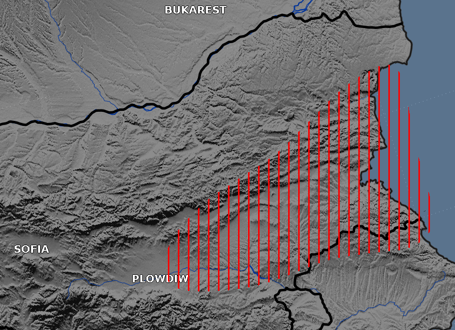
Latest nowcast data indicates a locked-in BL response N of constantly lowering MSLP atop the Aegean Sea in the form of persistent E-erly BL flow within the hatched area. Surface dewpoints are now in the 15 to 18C range with 2m temperatures soaring into the 23 to 27C range. Insolation is fine although we now see some advection of thicker cirrus from the SW due to the ongoing WAA regime. Latest sounding data near the area of interest indicates robust capping until now but CI is now underway along the orography of the Rhodope Mountains.
NWP guidance remains consistent in indicating growing and constantly intensifying convection, which shifts rapidly NE during the forcast. Deviating storm motion should result in more easterly tracks betimes.
MUCAPE will be in the 1000-1500 J/kg range with higher peaks along the S fringe of the highlighted area. Impressive WAA shear regime exists with curved and elongated hodographs although a decrease in wind speed near the anvil layer indicates a mix of classic to HP supercells.
Now merging cells cause broadening updrafts, which will be organized and long-lived as they race E until the evening hours. Weak LL shear, broadening mid-level CAPE, intense shear and not much entrainment (confindence in final degree of real CAPE build-up) point to (very) large hail and severe to damaging gusts (especially the combined effect of both will be damaging). Hail diameter in excess of 5 cm is likely. Probably the main reason for not adding the risk of giant hail is the lower end CAPE magnitude for this kind of hazard but storm-scale dynamics will decide about that.
Although we talk about mature supercells in the following hours, a well mixed BL should hamper storms to become tornadic in addition to favorable downdraft support by lots of precipitation load. Hence, repeated undercutting of the updrafts by surging RFD events is possible. Still an isolated event cannot be ruled out completely, especially if now-received dewpoints up to 20C verify (which would lower LCLs to 500-700 m on a regional scale with a robust increase in tornado probabilities). So we add an isolated tornado risk, with a strong event not ruled out.
The activity exits E over offshore areas, where a weakening trend occurs.