When vertical wind shear is large, supercell storms may form. Supercells have a longer lifetime than multicell clusters and single cells. The definition of a supercell is a thunderstorm that has a deep and persistent rotating updraft (Doswell and Burgess, 1993). About 15-20 m/s shear in the SFC-6 km layer is required for supercells to become a possible mode of convection.
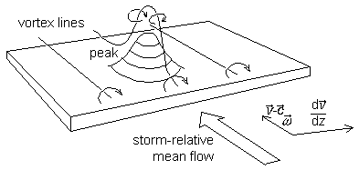
Fig. 1.13. The creation of vertical vorticity in an updraft in a sheared flow (see text for explanation). v is the low-level wind vector, c the storm motion vector, omega the vorticity vector. Based on a figure from Davies-Jones (1984).
Supercells are known for their capability to produce various types of severe weather including (very) large hail, flooding, damaging winds and tornadoes. An important reason for this is that they contain very high vertical velocities within both updrafts and downdrafts. Those velocities may significantly exceed what one would expect to result from the release of CAPE only. This is because dynamically induced vertical pressure gradients help to accelerate the upward and downward flows. The vertical pressure gradients form as a result of the interaction of the updraft within a strongly sheared flow. They may contribute as much to the vertical velocity as the release of CAPE.
Davies-Jones (1984) has provided a physical model to understand how a rotating updraft, also known as a mesocyclone, can develop. He has shown that upward vertical motion is correlated with positive vertical vorticity when convection develops in certain vertical wind profiles (see fig. 1.13). Whenever there is vertical wind shear, vortex lines that are horizontally oriented initially are tilted by a convective updraft. In combination with an increase of vertical vorticity by vortex stretching, two vortices form on the flanks of the storm.
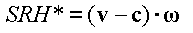
The rate at which streamwise vorticity (that is vorticity along an axis parallel with the inflow to the storm) enters the updraft of a storm can be quantified by the storm-relative helicity (SRH*):
This quantity is usually integrated over the entire layer that constitutes the inflow to the storm, often from the earth's surface to 1, 2 or 3 kilometres above ground level:
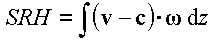
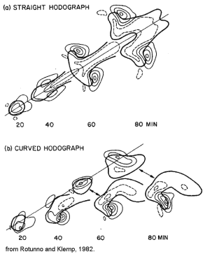
Fig. 1.14. Splitting storms. The thin contours denote mid-level upward (solid) and downward (dashed) vertical motion. The thick contour is a contour of reflectivity as seen on radar. From Rotunno and Klemp, 1982.
The interaction of strong wind shear and an isolated convective updraft generally causes it to split. The two updrafts move to the left and right of the mean wind vector and contain cyclonic and anticyclonic mesocyclones in the storms that move to the right and left of the mean wind respectively. If they persist and have deep rotating updrafts, they may be called supercells.
In the case that wind shear is not only very strong, but the wind veers strongly with height, the storm-relative helicity for the right-moving storm can become very large as will be shown below. At the same time, the left-moving storm has less storm-relative helicity available. As this has an effect on the intensity of the storms, the right-moving storm can expected to become stronger over time, while the left-moving storm will likely become weaker and may decay.
It was argued above that storm formation is often associated with large scale upward motion. Large-scale upward motion is often associated with warm advection and warm advection is often associated with veering winds with height . As a result in most cases of supercell storms, the strongest or even the only storms are the right-moving storms (fig. 1.14). The opposite situation, where which winds back with height, favours the left-moving storm. This situation is much less common.