Mesoscale Discussion
Valid: Fri 10 Jul 2020 12:00 to Fri 10 Jul 2020 15:00 UTC
Issued: Fri 10 Jul 2020 12:06
Forecaster: GROENEMEIJER
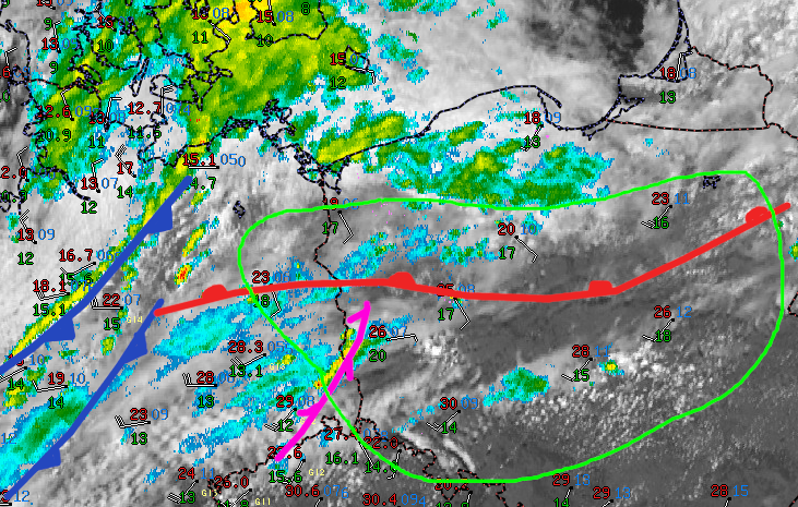
An east-west oriented surface warm front is located near a line from Berlin eastward to near Bialystok. South of it, storms are initating in an area of surface wind convergence near the German Polish border. In addition, an agitated towering cumulus field across central Poland (Lodz voivodeship) suggests initation may also occur there in the next few hours.
The storms develop in a strongly-sheared environment with 20-25 m/s of deep-layer shear, and weak to moderate instability (500-1500 J/kg). Well-organized storms including supercells are expected to develop, capable of producing large hail.
Across western Poland near the warm front surface winds are locally backed, which should result in a large low-level hodograph and ample storm-relative helicity (~150-200 m2/s2 in the 0-1 layer). This stronger low-level shear suggests that a tornado risk exists there with any well-developed supercell.
During the coming hours, scattered storms are expected to develop in response to diurnal heating, bearing a risk of large hail and severe winds. The region of highest tornado potential will be near the warm front in western Poland and gradually translate eastward into central Poland in concert with the area of maximum surface wind convergence as a cold front moves in from the west.
