Mesoscale Discussion
Valid: Tue 04 Jun 2019 16:00 to Tue 04 Jun 2019 19:00 UTC
Issued: Tue 04 Jun 2019 16:23
Forecaster: GROENEMEIJER
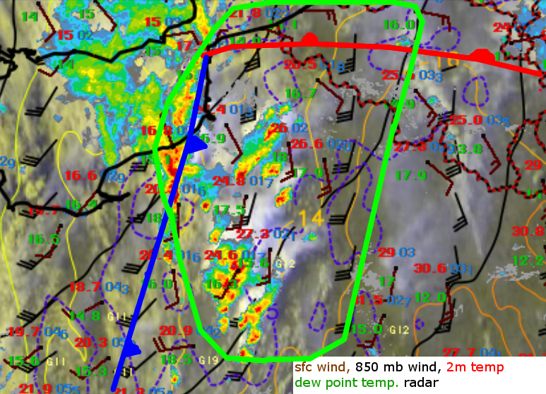
At 15:30 UTC, scattered storms have developed within the southern 2/3rds of the indicated area, but they have not intensified rapidly, probably because of limited upper-level support and the relatively strong wind shear. Within the area, substantial (1000 - 2000 J/kg) CAPE should be available and gradually the storms are becoming better organized. A few well-organized supercells are likely to develop with a primary risk of large hail, alongside a more limited risk of all other severe weather hazards.
Along the cold front, some linear organization has taken place and this cluster seems to have the highest potential to produce severe wind gusts as it evolves and moves northeastward during the coming hours and clusters with nearby storms. The amount of upscale evolution into bow-echo-like system is uncertain at the time, not the least because NWP guidance strongly diverges.
North of the warm front, mesoscale lift has not been sufficient for convective initiation. In that strongly-sheared environment that boasts high storm-relative helicity a high potential for severe weather would exist with any storm that forms.
