Mesoscale Discussion
Valid: Tue 04 Jun 2019 13:00 to Tue 04 Jun 2019 16:00 UTC
Issued: Tue 04 Jun 2019 13:33
Forecaster: GROENEMEIJER
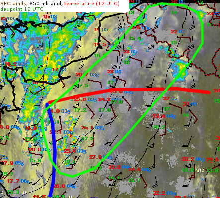
At 13 UTC, scattered towering cumulus across the northern Pays de la Loire, Normandy and Hauts-de-France regions were developing below a cirrus deck. Within this region, low-level humidity has gradually risen and 17-18°C dew point temperatures are observed at 13 UTC. Storm initiation seems imminent in this region. Given the strong deep-layer shear, they may develop quickly into supercells or bowing structures.
Across the northern half of the MD regions, winds are easterly north of a diffuse warm front, and strong low-level directional shear is occurring and increasing. Any storm that develops in this regime has a marked potential to develop strong low-level rotation and become tornadic. That said, convective initiation seems more hesitant here. The region should be monitored close for storm development.
